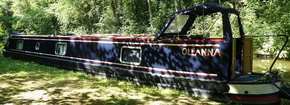
Haws Bridge to Upton Visitor Moorings
Hopefully with the Upton folk festival having finished yesterday the crowds would have all moved on and there would be space for us on the moorings, if not then we decided that we’d carry on to Worcester rather than breasting up three deep. We’ll be returning this way so we’d get a second chance.

 We pushed off at just gone 10am with extra layers on. Yesterday we were covered in sun cream wearing shorts and t-shirts. Today the t-shirts had a jumper and a fleece over the top. The world out there was a choppy hazy one as we carried on up stream. A couple of boats came past us into a head wind all wrapped up too. Gradually patches of blue appeared overhead, then they joined together and the temperature started to rise.

 The moorings at the Yew Tree pub were empty but looked like they’d been reserved at the weekend, maybe for regulars.

 An hour after setting off we reached Upper Lode Lock, we’d radioed ahead from the Yew Tree and the Lockie had said he’d dump the water in the lock for us, could we please wait till we saw the green light as currently the red light isn’t working. As you approach the lock cut you can see straight up to the weir and on the lock island there has been cut a tunnel through the trees for the Lockie to keep an eye out for you from his booth. We turned the bend and the light went green the lock gates already open ahead of us. For the first time, on the levels board we had two green lights flashing at us. The whole of the river now in the green, the first time we’ve seen this since the 29th of March, when we waited a touch too long at Stourport!
 It feels somewhat wrong to be the only boat in such a huge lock at least it only had to rise around 3ft for us to join the next reach of the river. We carried on heading north resisting the temptation to turn onto the Avon to ‘I do like a good’ Tewkesbury, that treat will be soon.

 Just after the wonderful span of Mythe Bridge there is an interesting house for sale. It used to be the Toll House for the bridge and has a second property the Alum House, it also looks like it has a river mooring.

 Every now and a again we got the glimpse of a boat up ahead, we were following someone. By the time we reached the M50 we reduced our revs a touch as we were catching them up. They seemed to move over a touch, so Mick took the opportunity before the next big bend and increased our revs and we sailed past giving them a wave. We’re not in a rush we just travel a touch faster. They gradually fell further behind us.
 At the gravel wharf there were only three of the barges we’d seen on our way south, the forth we’d spotted in a dry dock at Gloucester.
 Around a few more bends and then we could see the Pepperpot at Upton. Plenty of space on the big steps and only one narrowboat on the pontoon, so we chose to pull in and join them. By the time we’d reached Upton we’d both removed our top layers as the day was now starting to warm up.


 Upton was originally a busy port and had been the only river crossing for miles. Because of the number of boat hauliers arriving with the boats the town was filled with drinking establishments. In 1822 there were 17 Taverns and Coaching Inns and the population was 2,319. Today the number has dropped to 8 pubs but the population has stayed at a similar level 2,600. The wealth brought in by the port means there are large grand houses, in between the pubs, over looking the river.
 Over this last weekend there had been a Folk Festival and the town seems to fill it’s calendar with plenty of festivals year round, Blues, Jazz, Water, you name it they’ll make a festival out of it. All very popular, filling the town with visitors.
 The floods that struck the area in 2007 left Upton more or less an island surrounded and partially engulfed by the Severn. Dubbed Britain’s most flooded town they had temporary flood barriers which would be erected when needed. But in 2007 a flash flood hit in July, the barriers kept at Kidderminster got held up on the motorway due to the rising waters. Now walls with glazed tops have been put in place along the water front and large gates can be closed to help protect the town. The A4104 is currently being raised to avoid being flooded so that the town can stay connected to the rest of the world when the waters rise again.
 We walked along the river front past numerous pubs, people drinking and eating in the sunshine. Large houses sit proudly over looking the river some divided into flats, others still large houses, some grander than others.

 At the end of the For Sale properties lies Upton Ham an area of SSSI, it is almost 60 hectares of grass land currently covered in a haze of buttercups. Birds are nesting so you are encouraged to stick to the paths and walk around the edges to avoid disturbing them. This area floods and a levels board at a gate suggests how deep the water can get.

 A look around the graveyard and on to The Parish Church of St Peter and St Paul. The door was open and a chap was practicing on the organ. Our look around was slightly curtailed as when the organist finished he disappeared through a door into the vestry, then we could hear the beep beep beep of an alarm being set. Not wanting to risk setting it off we hastily left, hoping the main door hadn’t been locked. It hadn’t so at least we wouldn’t have to explain ourselves to the Police.
 A walk up Old Street brought us even more pubs including The Little Upton Muggery which has it’s ceilings covered in mugs. It being a Tuesday we managed to resist all the hostelries but made up for it with some chilled medication from The London Central Meat Co, now a sweat shop. By now we wondered if the locals had to survive on beer when the floods hit as we’d seen no food shops, but just around the next corner was a Co-op.

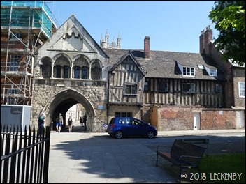
 A look around the informative displays in the Tourist Information Centre at the Pepperpot. This is the oldest building in Upton, the main body of the tower thought to have been built in the 14th Century, at that time a full church with a spire and two chancels. During the Civil War much damage was done to the building as it stood at the important river crossing. It continued to deteriate until 1754 when a new nave was built. But by 1770 the spire was considered to be unsafe so was dismantled, it was replaced by the wooden hexagonal lantern and lead cupola which later was clad in copper, giving the tower it’s pepperpot look. Overtime the church became too small for it’s congregation so a new Neo-Gothic church (the one we nearly got locked in) was built at the other end of Old Street to replace it in 1879. The old nave was dismantled in 1937 and the grounds made into a garden.
 1 lock, 10.91 miles, 2 lefts, 3ft up, 2 Kingfishers, 2 many layers, 1 overtake, 1 boat moored, 4 more to join, 8 pubs, 1 huge field, 2 meat chilled medications, 1 short rain shower, 2 many trees to climb just out of reach!
River Levels at 9am today Bewdley Stourport 0.622m
Diglis, Worcester 0.68m
Tewkesbury, Severn 0.592m
Tewkesbury, Avon 2.28m
https://goo.gl/maps/xL6DymQFr1m


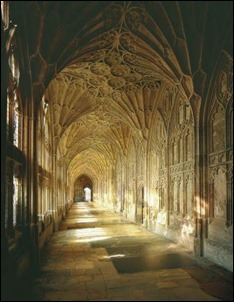
 St Mary de Crypt


 We followed the Old Arm down to the Old Tidal Basin and lock. Much of the Old Arm is now used for mooring and what was the lock down into the tidal basin has boats moored there too, the old lock gates still in position. Huge rings fixed by the wall are now far too big to moor a 35ft cruiser to, but are just a sign of the size of boats that once used to use the arm.
 The old lock and dock had only served to get the ships from the river and on their way to Gloucester, but now the constant level encouraged wharfs and warehouses to be built in Sharpness. With the arrival of the railway and swing bridges across the canal the dock became a port in it’s own right.
 In 1908 the old lock and basin were abandoned the old dock was used for boat repairs and by 1990 the gates were fully removed and replaced by a weir enabling the whole of the basin to be at the same height as the canal. Above what had been the River gate is the old Harbour Masters House, now used by the Severn Area Rescue Association. A Land Rover with Lifeboat written on it’s bonnet and a slipway a distance away suggests that there is a lifeboat stored away next to the house.
 The Harbour Masters House sits in a very exposed position, with views both up and down the Severn. Both Severn Road Bridges can be seen in the distance and we might even have spotted where Mick’s sister Kath once lived in Severn Beach. As soon as we walked out of the shelter of the house we had to cling onto our hats and the force of the wind was so strong it resonated the railings along the sea wall. It was very eerie, I tried to record the sound on my camera but the wind just upstaged it. From our position today and with the tide low we could see the wrecks of both the tankers that had collided with the railway bridge. We could also see that maybe a few more beached vessels were needed to help with bank erosion.
 We followed the track over to the newer docks, stopping to have a closer look at the wind turbine on the head land. They really are massive things, can you spot Mick at the base? Apparently it was really quite quiet stood next to the turbine as it swept round creating its 500 KW.
 From here we walked down to Dock Road where we followed signs for a shop. A few houses with what had been a Post Office, we decided to go inside and see if they had any potatoes. The lady behind the counter told us that when they lost the Post Office their income had halved, it was a good job that they had a very big paper round which helped keep them going. The only potatoes she had were tinned, not what we were after so we came out with a midweek newspaper instead.
 A string of houses look down to the dock and the old rail tracks, now mostly overgrown. The odd bit of old rolling stock sits idle, maybe waiting some TLC from some local enthusiasts. There were plenty of boats out on hard standing and more in the water. Planet the old Light Ship that used to be at Liverpool Docks has made it’s way here after being removed for not having kept up with it’s mooring fees (according to The Liverpool Echo). It is hemmed in by other large ships, one with a bladeless helicopter on it’s roof. A tall ship stands at the end looking in much better order.


 Whilst we had breakfast Tilly was allowed out, when she returned would dictate what we did for the day. The water gauge was reading just under a quarter full so we decided that when she returned we would carry on towards Sharpness stopping for water at an available water point. It was cold and very windy, so I got my padded waterproof trousers out again ready for the off.

 We pushed off once we knew there was no lasting damage done, both to Tilly and Oleanna. Through Splatt Swing Bridge, on past the Cambridge Arm feeder where a new build sits at the junction. After the next two bridges we pulled in for water. Just before the bridge there is The Black Barn, a cafe, gift shop and they sell red diesel. The Slimbridge Wetland Centre is just a short distance from here, we may stop and have a good look round on our way back, also have a top up of diesel.
 At Purton there are two swing bridges in quick succession, both operated by the keeper at the Lower Bridge. Cameras mounted high up catch you arriving. As you pass through the Upper Bridge the Lower one starts to open.
 The
The  Around the next bend is a long straight, which looks like it is very close to the Severn on the maps. We hoped for a mooring with a better view this time, only to be thwarted by high trees and undergrowth blocking virtually all the view. No break came until we’d passed the old Severn Railway Bridge. Here a wall would shelter us from the prevailing wind but also block our view, another trampoline required. Almost at the end we winded and pulled up. Tilly used the back doors to go out this time, but wasn’t too impressed at what greeted her.
  In the afternoon we wrapped up warm again. Walking up the canal you pass what was the Severn Railway Bridge. A typical start to any bridge sits on one side of the canal and a round stone support on the other. This support was once the pivot point for a rail swing bridge and it housed the steam engine that opened it to enable tall ships to pass along the ship canal. But why is there no other signs of the bridge crossing the river? The bridge was used to carry coal across to Sharpness docks for export. Opened in 1879, it was 3/4 of a mile long with 21 spans supported by cast iron columns sunk into the river bed.
 25th October 1960 disaster struck when in thick fog and on a strong tide two tanker barges missed the entrance to Sharpness Dock and were carried further upstream to the bridge. Wastdale H collided with the 17th column rupturing her petrol tank, Arkendale H was forced by the power of the tide on top of her. Two bridge spans collapsed rupturing a gas main and electric cable that passed along the bridge. All this led to a massive explosion. Three crew members survived and a train had missed the explosion by seven minutes. It was not economically viable to rebuild the bridge so the remainder was demolished, at low tide you can make out the wrecks of the tankers.
 On the shoreline are numerous other wrecks, known as the Purton Hulks. These ships were however beached with the intention of strengthening the canal bank from erosion form the river. It started in 1909 with the beaching of a small fleet of semi-redundant timber lighters, more followed through the years up into the 70’s and now The Purton Ships Graveyard has 81 vessels on the shoreline. Each vessel was taken out from Sharpness Dock on a high Spring tide, towed towards the shore then released so that it would charge up the bank. Holes were then knocked through the hull so that on subsequent tides the holds would fill with silt helping to reinforce the bank.


 The vessels are of various construction wood, steel and concrete. The later two materials withstanding the elements better than the wooden hulls. Archaeological research has been done to identify each boat and plaques have been mounted wherever a hull lies, listing it’s name, size and dates. Some are easily identifiable, others have very little left to show.
 A fascinating place to visit especially on a moody windy day. For far more information click on the