Category Archives: Middle Level

Crossing The Tide. 20th May

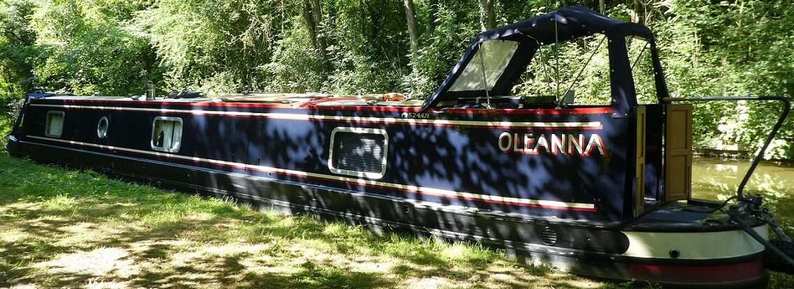
Glady Dacks to 2nd GOBA mooring, River Wissey

Another early start for us, we’d the tide to catch!

Only time for one birthday present before we pushed off, a sponge squeegee thing to help clean the solar panels, a Barnetts in York purchase on Tilly’s behalf.

Funny clouds

What a grey morning! The clouds above us looked like someone had rolled out a load of wadding or that we had been covered by a large grey focaccia. Waterproofs were at the ready should they be needed, they were later on.

Salters Lode

We arrived at Salters Lode around 9:30, a chap in high vis asked if we’d be going through the lock today. Yes. He would be our lock keeper, we should be ready to go at 11:30, he’d just been down to let two long boats through the lock. Salters Lode Lock is 62ft long and heads out onto the Tidal River Great Ouse. If your boat is longer than 62ft then it is still possible to pass through the lock when the level of the river matches that of the creek, both gates on the lock open at the same time. He checked our length, we’d be fine, then he went to chat with NB Tank Girl they’d also be going through today.

Lock gates open

We walked up to look at the lock and river. Mick had spent sometime last night watching Youtube videos of boats coming and going through Slaters Lode and Denver Sluice (the lock to get onto the non-tidal River Great Ouse. But there’s nothing like seeing the lay of the land/river and the speed at which the water passes by first hand.

The tide was on it’s way in. Outside the lock we could see the railings that help guide you into the mouth of the lock and hopefully avoid ending up on the sand banks. We then walked along the flood bank towards Denver Sluice, over Old Bedford Lock. Just half a mile of tidal water lays between the two locks. Denver Sluice looked bigger and more substantial with it’s big guillotine gates. Time for a cuppa back on board before the tide would be right for us.

At 11:30 both boats were ready. The lady from NB Tank Girl headed off to see if she could find the lock keeper, I followed in case we’d be told anything important. The chap took some finding as he was actually on the river side checking the depth of water, I couldn’t quite see, but I think he was in waders with a stick just on the side we’d seen a couple of hours earlier just sitting out of the water. ‘Another half hour’ he said. There are all sorts of factors to take into consideration at Salters Lode, tide, fresh water, an exact time can’t be given, but a good measure is required.

By now it was raining. Would our planned barbeque still be on or would we be lighting the stove and having jacket potatoes for Mick’s birthday meal?

About half an hour later the Lockie came to say the level was good, he was ready for us. NB Tank Girl went first, one boat at a time through the lock. They detached their chimney and laid it on the roof, air draught kept to the minimum. The bow rope was passed round a chain to help keep their boat into the side, then a sluice was opened letting jets of water into the lock. It doesn’t seem right that we’d be going up onto tidal water.

As the boat rose the Lockie kept reminding the lady to duck as she was positioned directly under part of the structure that was getting closer and closer. Then the guillotine gate was raised, would their boiler flue fit under the bridge? Out on the river the tide was now going out, they could wait for the level to be suitable to get out, but they managed to sneak out.

Swapping boats

The Lockie made a phone call to Denver Sluice, there was a boat coming the other way, down stream. Both boats exited their respective locks at the same time and would pass somewhere on the half mile between, a bit like exchanging spies at Check Point Charlie. We watched NB Tank Girl exit, put the revs on and push her tiller over to head upstream and into the out going tide.

From up ahead we could see NB Annie heading downstream, the two boats would end up passing on the wrong side, but that didn’t really matter. The Lockie stood high by the lock, his high vis coat worn for a reason. He held his arm out pointing to downstream, NB Annie held her course. Then when his arm was dropped, the chap at the helm began his turn. As you would at Selby he swung around to face the out going tide and then inched his way back towards the lock. Did he have enough power to avoid hitting the downstream wall? Did he have too much power on and be going to miss the fencing and end up on the sand bank?

Annie coming down to the creeks level

In the end he glided in towards the lock, touching nothing. As he came into the lock his voice sounded familiar, hang on was it Paul the narrowboat mover. Sure was. He remembered us too, our paths having crossed at Bosley two years ago and up on the Leicester Section last year. Good to see him again. He bought a one day licence for the Middle Level, he’d be across and out the other side by 10:30am tomorrow.

As soon as Paul was clear of the lock it was our turn. Rope passed round the chain, sluice opened. By the time the guillotine raised the level of the out going tide was already about 18 inches lower than it had been for Tank Girl. We thanked the Lockie then Mick nudged the bow out of the lock towards the tide.

Revs, tiller and we were facing the tide in the rain, great birthday weather! The half mile didn’t take long and we were soon entering Denver Sluice which was sat waiting for us. A stern rope was passed round a riser, the guillotine dropped behind us. We’d be going down off the tidal water and onto the River Great Ouse.

The River Great Ouse, wide and deep

Another Lockie to thank as we came out and onto the wide expanse of river. As we made our way upstream we discussed what to have for lunch. A bowl of soup maybe, or a bacon butty. The bacon won!

Much narrower River Wissey

A mile and a quarter upstream we spotted the turn onto the River Wissey and took it. Under the railway bridge we pulled in at a GOBA mooring. The Great Ouse Boating Association are similar to Friends of the River Nene and have moorings for members to use, membership £23 a year.

This will do

The mooring was showing signs of subsidence, little of it level. With another mooring just a short distance further on we pushed off and tried there instead. We pulled in and made ourselves at home. Lots of birds for company and a herd of sheep on the other side who seemed to head off in a hurry for a hair cut.

Blowing out the candles

Lunch, bacon butties was followed by Birthday Cake, Blueberry Lemon and Almond cake. Candles and everything.

Is it present time?

Then presents. Mick got the latest edition of the Imray guide to The River Great Ouse and it’s tributaries, featuring several photos of Heather and her boat NB Bleasdale, we’ve also spotted Simon on NB Scholar Gypsy in there too. He also got a new blue tooth keyboard and mouse for his tablet computer, the current one’s had been working intermittently for a while.

As Tilly explored her surroundings we hid inside hoping the weather would improve. Sunshine came and went, but the rain didn’t return. So late afternoon Mick found what he thought would be the more sheltered part of our mooring and set up the bbq as I threaded veg and haloumi onto skewers and wrapped salmon and bananas up in foil ready to cook.

Cheers! Happy Birthday Mick

Maybe a little bit chilly, but we still enjoyed our private mooring with food and wine. Tilly was given an extension to cat curfew. She spent most of it staring into the friendly cover with the occasional break to climb a tree.

Setting sun

2 locks, 4.93 miles, 1 leftish, 1 right, 1 left, 0.5 miles of tidal water, 1 creek, 2 rivers, 1 wet day, 1 mover, 1 cake, 12 candles, 2 cards, 3 presents, 2nd mooring, 7 hours shore leave, 8 asparagus tips, 4 veg haloumi kebabs, 2 salmon steaks, 1 sunset, 1 Mick 1 year older.

https://goo.gl/maps/Ct4dy6QBBGWs5H9e9

Shed After Shed After Shed. 19th May

Burnthouse Farm Bridge to Glady Dacks, Well Creek

What’s going on here?

Plenty of miles to tick off today so no lounging around in bed with a cuppa. Other people were up and at work, as we sat having our breakfast two Middle Level Commissioners vans arrived on the bank above our mooring, they’d come to make the mooring official by adding a sign.

The chaps worked away and as we got ready to push off they headed off to position the next new sign.

We pushed off and headed towards March. The birdies chirped and darted about in the reeds to each side of us. The banks a suitable height to give you a bit of a view, not block it totally. Yesterday we’d passed several pill boxes today at least one more.

Fairly soon we were approaching March, passing the marina where the hire boats have been coming from. Everyone in March seems to have a detached garden. Houses sit on one side of a road, their gardens on the other, terraced down towards the water. Plenty of people have made a great effort, places to sit out, landings, windmills, crocodiles. One stretch seems to have an epidemic of sheds going on, one after the other with just a narrow path between them.

The first public mooring we came across was closed the bank subsiding into the water. The moorings opposite the services was full, we pulled up to top up with water, dispose of rubbish and as it was on the right side we emptied the yellow water too. Thankfully through the bridge there was space, plenty of it for us to pull up to go shopping. Yes I did a shop in Peterborough, that was really just in case we couldn’t stop here in March, there was plenty we wanted and with Sainsburys close by it turned into a four bag shop. A visit to Boots too for some Hay Fever tablets of the right variety, I spotted a Boyes (possibly the furthest south they come), we’ll be stopping to have a better look later.

After an early lunch we pushed on, passing more houses and gardens, one stretch trying to mimic beach huts. The sky was now blue with fluffy clouds, no need for the extra layers we’d started the day with.

Straight on past the Twenty Foot River which seemed a touch wider than it’s name suggests. At Popham’s Eau junction we veered left keeping to the link route. We passed Charlotte Rose whom we’d shared the last Nene locks with and a hire boat sat nestled in amongst the reeds enjoying the afternoon sunshine, no rope visible, the gentle breeze just holding them to the bank.

As the channel now narrowed there was an increase of weed, the sort that hampers your progress somewhat. Thankfully today it wasn’t too bad, just the occasional blast of reverse to free the prop was needed.

A Lock!

A lock! Marmont Priory Lock would rise us up from the lower level by 6ft 8inches onto Well Creek. The lock was partially filled, hydraulic paddle gear needed to be wound so many times slowly inching up the slackers.

Oleanna waiting below the lock

Inside the lock was a layer of scum, possibly dead duck weed mixed with polystyrene, there was also a big plank.

The paddle gear at the top end only required one to be lifted and that had a marker on it. Oleanna rose up to Well Creek right by the rather pretty front door of the lock cottage. Progress was now slower than before. The gates of Marmont Priory Lock need to be very well closed so that the creek stays in water, a drop here can take days to rectify.

Upwell

Progress slowed even more as we reached Upwell where the channel narrows even more. We ended up on tickover to make any headway, the water around us just about enough for us to move.

Upwell and Outwell reminded us of villages we go through on our scenic route from Scarborough to York. The linear villages cling to the road and have a stream running alongside, driveways crossing on small bridges. Here the stream is far bigger and it’s mostly footbridges that crossed over our heads requiring us to duck.

The houses mostly have plaques boasting their names and dates. A butchers was spied and the fish and chip shop has it’s own mooring! I’ll have to check to see if they do gluten free. We made note of moorings as it looks like we’d need to have a good explore around here.

Sign posts to Littleport and Wisbech. An old college friend came from Wisbech, she used to say no-one had ever heard of it, well I have now! At the most northerly point of the Middle Level is where the Wisbech Canal used to head further north, now it is just a steep bend for us to negotiate. There’s a mooring here, but maybe you’d get biffed by passing boats!

That’s pretty wide

Over Millicourt Aqueduct we crossed over the end of the Main Drain, such a romantic name. It looked very wide down there so possible to wind, we’ll have to check our maps for any low bridges that would stop us from getting there.

Now a busy road, A1122 hugs close to the creek. The banks now lower giving more of a view. Pylons stretch off into the distance both ways, only broken up by two smaller towers. I checked on the OS map, almost 21 km straight before a slight kink.

Our planned for mooring just came into sight, Glady Dacks. A rather rickety afair, one end looked better than the other. We pulled in and stepped off cautiously. A bench and table sat by Oleanna, a good means to be able to step up to see the other side of the high bank separating the road from us. On one side it looked like Tilly heaven, the other side it looked like she’d be assisted on her way. Sorry Tilly, no chance.

But please!!!!

Now there were secret things to do. A birthday cake was mixed up, popped in a loaf tin to bake. It needed a bit of attention as it baked, added toppings, foil and an extra five minutes in the oven, then once cooled off some lemon icing.

Lower banks

Dinner was Turkey Schnitzel with spaghetti, I was too busy to take photos so the recipe will follow the next time I make them. Then Tilly and I had to hide away in the bedroom to do secret things. Wrapping on a bed isn’t the easiest of places but we managed. All done and ready for tomorrow just before the 10pm news, I don’t think Mick noticed a thing!

1 lock, 16.84 miles, 2 maybe 3 straights, 1 left, 1 big bend, 2 boxes wine, 1 Boyes, 60 hayfever tablets, 1 slab of salmon, 8 asparagus tips, 1 warm dry evening hoped for, 3 evenings no shore leave, 1 long day, 3 presents wrapped, 1 blueberry lemon cake baked, 2 much icing, 1 pooped Pip.

https://goo.gl/maps/UjsDib8W8YWnqPoN7

Is This As Low As We Can Go? 18th May

Dog in a Doublet to Burnthouse Bridge Rural Mooring, Whittlesey Dyke, Middle Level

This mornings mooring

Yesterday Mick had phoned Stanground Lock to book our passage through for today. Kev, not Tina had called us back and booked us for midday. He also rang us this morning, yesterday he’d responded to a missed call on the mobile, today he was responding to Mick’s message.

We gave ourselves a couple of hours to return back up the Nene to Peterborough Junction where we’d turn onto the Back River, the aroma of partially cooked chips hanging in the air today. Does anyone know what the metal framed tower is on the north shore of the river?

This way

The Back River brings you under a railway bridge, then past the back of the houses at Stanground. Soon we arrived at the lock and Kev popped up from nowhere, we were an hour early just as the timings on our maps had suggested, but better early than late.

Kev set the lock, the nearest paddle/slacker lifted to fill it, I could see straight through the opening, you don’t often get a view like that. With the gates open we were soon in the lock. Time to chat Anglian Passes.

Entering Stanground lock

About a month ago Mick had applied for an Anglian pass on line. This gives you access to the Middle Level and the River Cam and lasts a year. The pass is a fairly new thing and has caused quite a to do in certain circles. The website had said someone would ring to take payment. No-one did. So with our arrival getting closer Mick rang and was told that our application hadn’t arrived, could he fill out the form again and email it to them, then someone would call to take payment. This he did. We are still waiting for the phone call.

Kev opening the gates for us

This tale was nothing new to Kev, he wasn’t surprised. He wrote us down on his sheet and took our details. Next we needed to purchase ourselves a key and a key. A different navigation authority means a new key to access facilities. We also required a different windlass, which in these parts is called a key. Kev had both for sale and quickly provided them in return for £17. We also enquired about Salters Lode on the other side of the Middle Level, we’d tried calling the Lock Keeper there but had had no response. Kev said we’d just need to arrive at a suitable time for the tide, he then provided us with the tide time. No need to book just turn up and we’d be locked through. What a helpful chap, very reminiscent of the Lock Keeper at Thames Lock onto the River Wey.

New keys

The paddles on the lock were lifted, the lock emptied, gates open. We’d descended onto the Level. Well maybe we’d descended a touch too far as Oleanna seemed to want to stay put in the lock. There was a little bit of movement so a push out at the stern and bow a bit of a jiggle and she was free! We are on the cusp of draft for the navigation. Mick later on read notes written by Simon Judge regarding deep drafted boats going through the lock backwards, well we know now!

Lots of sky and pill boxes

Narrow and shallow, our speed would be a lot slower than it had been out on the river.

Here sky rules, when would we get to see our next hill? Flat as flat, well until we came across a new railway bridge being built.

Work boats and churches

A view of the brick works and McCains from the other side this time. Two churches in Whittlesey. Three work boats sat at the edges of the navigation, having their lunch break, weed cutters, one called Covid 20.

Ahead lay the bend we’ve heard of between bridges 111 and 110, the navigation is narrow the bend 90 degrees. Mick slowed Oleanna right down as we passed possibly the nearest vets to the waterways, then took us round in one go with plenty of room to spare.

They don’t want you hanging around here

A public park in Whittlesey has a 48hr mooring, space for two narrowboats, we pulled in for lunch then consulted our schedule. Should we stay here the night? We were already ahead of schedule, Tilly would be able to go out, other moorings further on looked like they would be alongside roads, so not deemed to be cat friendly.

What’s happened to the friendly cover?

‘Two hours Tilly, we might want to go out and explore ourselves.’

Another look at our schedule, planned mooring places for the next few days. Waterway Routes open as well as Google Maps satellite view. A meeting with family is planned next week, a mooring to have a birthday barbeque would be good too, so we’re only using the link route through the Middle Level at the moment. Our planned passage through Salters Lode to Denver Sluice had been on Saturday, but all of a sudden the moorings on the Great Ouse looked a touch more appealing. Did we have enough time to reach Salters Lode for Friday morning? If we cracked on today yes.

Weed cutters hot on our tails

Fortunately Tilly had decided that the grass outside wasn’t up to much and had retired to the bedroom, but as soon as the back door closed we got complaints. ‘You know I said 2 hours, well I actually meant 2 minutes!’

Ashline lock

Ashline Lock drops the navigation down by 6ft, it lay a short distance in front of us. The width of the locks isn’t enough to be able to share with another narrowboat, bottom gates should be left open, paddles closed to help conserve water levels. Time to use our new windlass/key, so new it’s grey paint not fully cured!

The paddles at the top of the lock are similar to those you find on the Leeds Liverpool canal, you just can’t see whether they are open or not, then how many turns until they are fully open? The lock gradually filled. The bottom paddles are similar but positioned on the gates themselves. I chose to count how many turns they took to open, twenty, thirty, thirty five, I gave up, the lock slowly emptied.

Red and Yellow

Is this the lowest you can be on non-tidal water in England? At Lodes End Lock to our south the level is variable and can be nothing, but it suggests on our map that to head west through the lock you may rise to be on the level we are on now. Around us the contour on the OS map was around 0 or even -1 in some fields.

In the pamphlet we’d been given it showed us the location of Rural moorings, but Mick had spied on the website that there were another four such moorings, two of which we’d be going past today. Might they be more cat friendly than the public moorings?

The first was at Angle Corner. 32m of bank had been cut and large posts added to tie to. Here you might be able to get off your boat without too much trouble, but the bank is steep, nothing that would worry Tilly. We made a note of its position to report back to Paul at Waterway Routes.

It’s really rather pretty round here

Just past Burnthouse Bridge there was a second mooring. We consulted our maps, if we didn’t stop here we had at least another two hours to cruise to the next mooring in March which may not have space. We pulled in flung our ropes over the posts, Oleanna sat a good meter out from solid land, a plank or major leap of faith would be needed here to get off, but that didn’t bother us. A quick cat health and safety discussion, she’d get off okay, but would almost certainly arrive back on board wet. No shore leave today for any of us!

2 locks, 13.89 miles, 1 wind, 1 left, 1 straight on, 1 hour early, 2 minutes shore leave, 2 hire boats, 1 private boat, 3 work boats, 1 new key, 1 new key, 2 levels, 10 new posts, 1 contract to sign, 1 storm approaching, 0 Anglian Pass.

https://goo.gl/maps/yqpCcmpAE7s4gvee9