Selby Basin to ………….
Heather arrived yesterday afternoon with lots of goodies she’d picked up in Doncaster at Scicluna Deli. One of the slices of cake had to be enjoyed with a cuppa as we discussed our cruising plans for Trent Falls. Not being able to get off the river at Keadby was still a sticking point for us all, who could we call other than another helpful Lock Keeper?

We enjoyed a curry from Jinnah, thank you Martin for the suggestion, it was very tasty, and a bottle of wine, then it was early to bed ready for the off this morning.
I have to admit to not having had the best nights sleep as I was not looking forward to mooring up on the pontoon in Gainsborough as the river hurtled past at a rate of knots. Tonight’s high tide would be the highest of the spring tides, 7.84m at Hull, so our plan of doing the trip on a Neap tide hadn’t worked out!

This morning whilst Mick made us bacon butties Heather walked over to chat with the Lock Keeper, it was worth another try. The chap on duty this morning didn’t know Keadby or really our planned cruise, so he couldn’t be of much help, but would call his supervisor. As we finished our butties he came over to chat, today the problem was more to do with the sandbar at Keadby Lock than staffing. They were saying there wouldn’t be enough water to get us over it and into the lock at the state of tide when we arrived. He tried again for us, but the answer was still no.

By now two chaps from the Environment Agency had arrived, they had checked the height of the tide and were happy that it wouldn’t over top the lock so then wound back the flood barrier. Life jackets on, Escape pod at the ready, the sun was out, it was time to go.


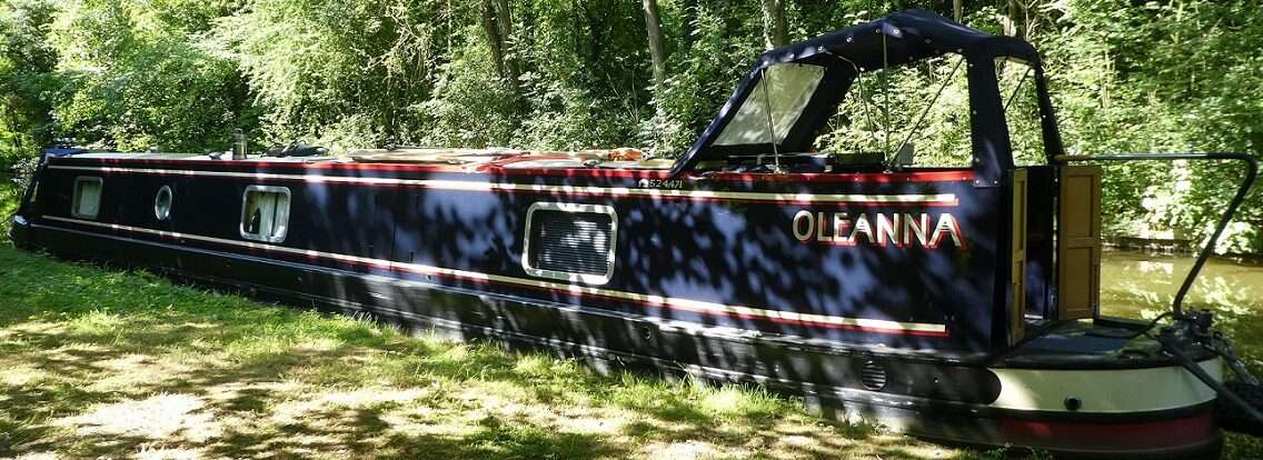
David, Karl, Martin and Wendy came down to the lock mouth to wave us goodbye and take photos for us, not often I get photos of me on Oleanna. The lock emptied, not much today due to the spring tide.


Then it was time to put the power on, leave the lock and wave goodbye to the rest of the escape committee. Thank you all for your company, knowledge, apps, photos and our united escape. Hopefully our paths will cross later in the year when we come back up north, but for now enjoy York and pottering about until things open up again.


Out into the flow we soon picked up speed. Mick radioed ahead to Selby Bypass Bridge to check for air draught. It was 4m so not a problem even though Mick got his tongue tide saying that our air drought was 2ft!


Soon the flow got going and our speed increased. We needed to make sure we reached Boothferry Bridge before the tide dropped too much as here sand banks start to show themselves at low water.
Heather has travelled this stretch of the river before some years ago. Selby Bypass Bridge looked new to her. We couldn’t spot the bridge keeper in his high up perch to give him a wave.

Drax Power Station came into view, the steam from the cooling towers heading straight up. The weather forecast and information on the Windy app were holding true.

I’d set Nebo going and could see that our speed was increasing, the sun that we’d left Selby in made us think we were over dressed for the days cruise, but now out on the river we were glad of the extra layer.

Once we reached Barmby Barrage we were now onto new water for Heather.


Passing a wharf close to Drax Power Station there was a high vis rescue boat. Two chaps sat in the rib. You could play spot the difference with these photos, I think one of the chaps spotted us and put his helmet on quick.


A crane sat in a field alongside the wind turbines. Was it a new turbine being put together or had the lid been lifted off? A chap sat high up there working away.

We passed where the River Aire joins the Ouse, then Boothferry Bridge and the M62 lay ahead.


There was no need to radio ahead, although the Bridge Keeper kept a close eye on our progress. So far so good, we wouldn’t run out of water.


Under the M62. This bridge can be seen for miles with it’s gentle curve up and over the Ouse and surrounding area, it always used to be hard to slow down on the slip road off it at Howden. The salt and pepper pots in Goole could just be seen through the uprights meaning we’d soon be back where we started last Friday.

Round Howden Dyke Island, the sand banks only just starting to show themselves, then straight across to the first wharf surrounded by the green of Wren Kitchens. A right angle to keep to our red line on the charts and keeping towards the eastern bank of the river. Here two large ships were being loaded, a reclining figure kept an eye on things, looking down into the hold.


Last Friday we’d been surprised at the lack of debris on the river. You seem to get a lot of it on the reaches up to York. Today however was different, there was plenty of fire wood floating along keeping us company, some of it at one point needed some encouragement to leave us, we slowed down and let it drift off ahead.


Goole Railway Bridge. Today we took the span to the east of the control tower. Here we could see the earlier wooden protection, now superseded by a steel structure, it’s a good job as it looked like the wood wouldn’t be able to cope with a miscalculation from a passing ship.

Now the river sat wide in front of us. The view of Goole clearer than last week. We followed the red line on our charts, taking us across the river closer to the docks.


Victoria Lock entrance came into view, a big yellow sign asking us to radio Goole Docks on channel 14. We’d tried a little bit earlier, but gave it another go.

‘Goole Docks, Goole Docks, this is Oleanna, over.’
The now familiar voice from Ocean Lock replied and Mick gave our location and informed him that we would soon be passing. We were clear to proceed and there was no traffic on the river. ‘Have a pleasant journey on the river’. Thank you.

Now we could finally wave goodbye to Goole.
New water for everyone. Even Tilly was shouting about it below!


We kept our eye out for the markers on the banks. White diamonds to line up and cross between. Numbered posts with what look like Ikea guiding lights on top of them, these are of course more elaborate than just a nightlight helping to show ships in towards the docks.

Yesterday Mick had spent several hours studying the Humber charts and comparing the depths to the red line on our Boating Association charts. The Humber has sand banks that constantly change so the river is surveyed bimonthly, our charts may have been out of date. However the red line followed the channel, so as long as we didn’t stray we should be fine.


A truncated windmill, a lighthouse that both Heather and I thought had a sign with two arrows on it, one pointing upstream the other down stream. Well now looking at my photos the arrows are actually just bolts holding the board to the lighthouse.

Lighthouse! Hang on, lighthouses tend to be at sea on the coast. The occasional one has been built as a whimsical curiosity along side a canal, but this one looked like the real thing and meant business.


Next Blacktoft Wharf came into view. When we’d visited it a few weeks ago by car we’d not liked the thought of mooring to it to wait for the tide to turn. Today we liked the look of it even less for a narrowboat and were glad we had a different plan for awaiting the tide.

There up ahead was our next landmark the Apex Light.
Straight on the Humber and North Sea, to our right the River Trent. Gulp!

The flow was making our progress so easy, zipping along, so far so easy, so easy. The sun was out, only a slight breeze, wonderful.


The Apex Light got closer. And closer. And closer.

Some people say to head down onto the Humber to bide some time waiting for the tide to turn. Others turn and beach their boats on the sandbanks on the southern side of the Humber. But our plan was different.

David and others had said that beaching might mean that as the tide comes in a wave would build up alongside your boat, trying to force you round. Until the level had risen enough for you to back off the bank this could mean water getting in through vents etc. Maybe on a neap tide this wouldn’t be so bad, but today was the highest spring. So our plan was to anchor instead.

Mick moved the tiller round and we turned round the Apex Light. Out from one flow of tide that had been pushing us along to head straight into another! Well we slipped along side ways for a bit before Oleanna managed to turn . Within a minute we changed from doing about 7mph over ground to almost being stationary now facing up stream on the river Trent.

1.5mph meant we crawled up the Trent, keeping quite close to the training wall which was very visible at this stage of the tide.

S L O W L Y we passed the two Trent markers on the west bank. We had to keep close to the training wall as here there is a shallow channel, not the main one, that is over the other side towards the eastern bank. David had given us a landmark to look out for, a drain leading into the channel, this was shown on our charts as being between two anchors.

Heather and I went up into the bow. The anchor had already been placed on the bow locker at the ready, the bucket of chain and rope beside it. I lifted the anchor, Heather the bucket.

I tried carefully to lower the anchor into the water, keeping control as it passed the newly painted gunnels. However it proved a touch too heavy to manage this totally. Clinging onto the chain letting the anchor slowly drop was hard work, so once all fingers were well out of the way I let go of the chain.

The chain followed by the rope pulled out of the bucket, leaving a couple of meters behind, which I assisted out into the water. Now would it bite on the river bed? Mick moved us gently, the flow on this part of the river much much less than in the main channel.


After a while the rope seemed to be getting some tension in it. However it was caught underneath the lower bow fender. Then we drifted over where the anchor must have been, the rope moving down the side of Oleanna. Then back again. I wasn’t willing to try to get the rope from under the fender as this would mean balancing on the bow, I’d rather loose the fender than fall in. But after a while things settled down and the rope sorted itself.

We were at anchor at Trent Falls.
Fabulous reading! What a great cruise this is turning out to be out on the huge commercial rivers in your flat bottomed Narrowboat. Hope it goes well in the next episode!
Tidy.
Cheers
Ade